


Morlan Township Voting District, Graham County, Kansas
About
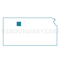
Outline

Summary
| Unique Area Identifier | 584872 |
| Name | Morlan Township Voting District |
| County | Graham County |
| State | Kansas |
| Area (square miles) | 110.50 |
| Land Area (square miles) | 110.48 |
| Water Area (square miles) | 0.02 |
| % of Land Area | 99.99 |
| % of Water Area | 0.01 |
| Latitude of the Internal Point | 39.21262920 |
| Longtitude of the Internal Point | -99.70201330 |
Maps


Graphs
Select a template below for downloading or customizing gragh for Morlan Township Voting District, Graham County, Kansas


Neighbors
Neighoring Voting District (by Name) Neighboring Voting District on the Map
- Happy Township Voting District, Graham County, KS
- Millbrook Township Voting District, Graham County, KS
- Ogallah Township Voting District, Trego County, KS
- Township 08 Voting District, Rooks County, KS
- Township 09 Voting District, Rooks County, KS
- WaKeeney Township Voting District, Trego County, KS
- Wildhorse Township Voting District, Graham County, KS
Top 10 Neighboring County Subdivision (by Population) Neighboring County Subdivision on the Map
- WaKeeney township, Trego County, KS (2,254)
- Township 8, Rooks County, KS (341)
- Wildhorse township, Graham County, KS (210)
- Ogallah township, Trego County, KS (173)
- Millbrook township, Graham County, KS (108)
- Morlan township, Graham County, KS (64)
- Happy township, Graham County, KS (54)
- Township 9, Rooks County, KS (48)
Top 10 Neighboring Unified School District (by Population) Neighboring Unified School District on the Map
- WaKeeney Unified School District 208, KS (2,855)
- Hill City Unified School District 281, KS (2,465)
- Palco Unified School District 269, KS (817)
Top 10 Neighboring State Legislative District Lower Chamber (by Population) Neighboring State Legislative District Lower Chamber on the Map
- State House District 110, KS (20,985)
- State House District 121, KS (19,063)
- State House District 118, KS (18,449)
Top 10 Neighboring State Legislative District Upper Chamber (by Population) Neighboring State Legislative District Upper Chamber on the Map
Top 10 Neighboring 111th Congressional District (by Population) Neighboring 111th Congressional District on the Map
Top 10 Neighboring Census Tract (by Population) Neighboring Census Tract on the Map
- Census Tract 9747, Rooks County, KS (3,130)
- Census Tract 9558, Trego County, KS (3,001)
- Census Tract 9521, Graham County, KS (996)
Top 10 Neighboring 5-Digit ZIP Code Tabulation Area (by Population) Neighboring 5-Digit ZIP Code Tabulation Area on the Map
- 67637, KS (2,651)
- 67672, KS (2,359)
- 67642, KS (1,729)
- 67657, KS (429)
- 67625, KS (257)
- 67632, KS (227)
- 67656, KS (156)